
In collaboration with National Geographic, the KGA has obtained Kentucky Giant Maps to loan out to schools to support geography in the classroom. The KGA is seeking Kentucky elementary schools to house our Giant Maps in Fall of 2022.
|
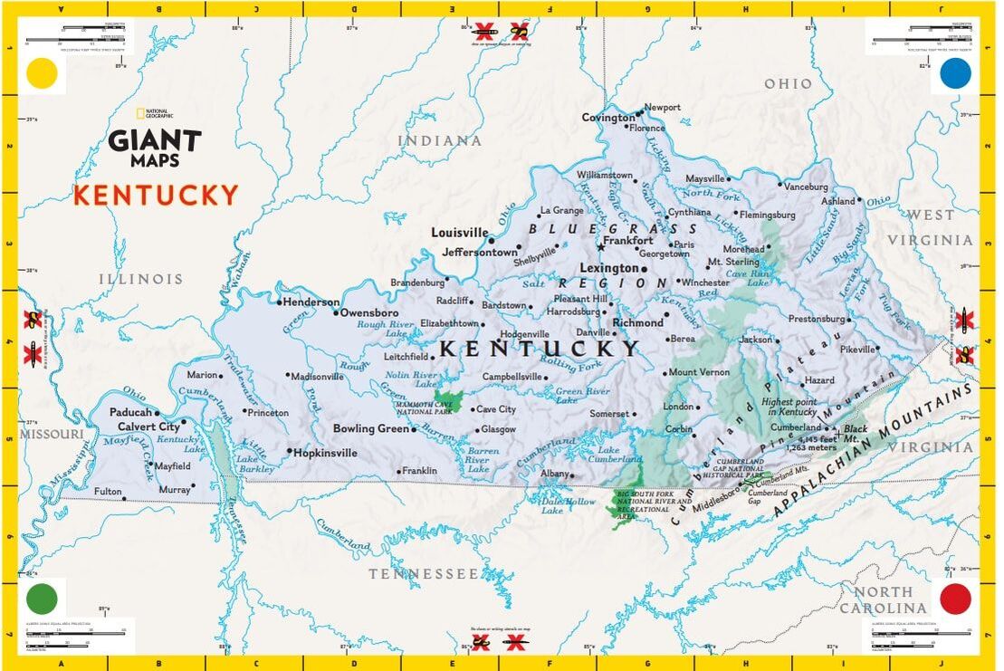
The National Geographic Giant Maps are large portable maps depicting areas across the world. The image below depicts the Giant Map for the state of Kentucky.
The KGA is developing lesson plans to accompany the Kentucky Giant Map. These lessons, in addition to the lessons provided by National Geographic, encourage students to think spatially: a skill that involves visualizing, interpreting, and reasoning using location, distance, direction, relationships, movement, and change in space. |
ABOUT THE KENTUCKY GIANT MAP |
Map dimensions: 21 x 17 feet
Key: The Kentucky map depicts locations of cities and towns, the state capital, the state boundary, the National Park Service, and National Forest land. The key for the map can be found here. Handbook: The handbook for the state giant maps, which includes information about spatial thinking in elementary students as well as lesson plans for the maps, can be found here. |
RESERVE A GIANT MAP FOR YOUR SCHOOL!
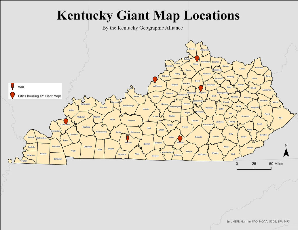
Map Locations:
Crittenden County Elementary School (Marion, Crittenden County, KY), Wolf Creek National Fish Hatchery (Jamestown, Russel County, KY), Sayre School(Lexington, Fayette County, KY), Crittenden Mt. Zion Elementary (Dry Ridge, Grant County, KY), Office of Teaching and Learning for Jefferson County Public Schools (Louisville, Jefferson County, KY)
In collaboration with National Geographic, the KGA has obtained Kentucky Giant Maps to loan out to schools to support geography in the classroom. The KGA is seeking Kentucky elementary schools to house our Giant Maps in Fall of 2022.
To check out a map, use the following instructions:
- Find the location that houses the map closest to your location.
- Use the contact information to call or email to schedule a time to use it. Each location that houses the map has a system for checking out the map to area schools.
- The person checking out the map is responsible for:
- Transporting the map to and from the location where it is housed.
- Returning the map with all of the items that came with it.
Bowling Green: Lexington:
Kentucky Geographic Alliance Sayre School
Department of Earth, Environmental, and Atmospheric Sciences 194 N Limestone Street
Western Kentucky University Lexington, KY 40507
Contact name: Jill Brown (859)254-1361
[email protected] Contact Name: Jackie Gallimore
[email protected]
Kentucky Geographic Alliance Sayre School
Department of Earth, Environmental, and Atmospheric Sciences 194 N Limestone Street
Western Kentucky University Lexington, KY 40507
Contact name: Jill Brown (859)254-1361
[email protected] Contact Name: Jackie Gallimore
[email protected]
Louisville: Northern Kentucky:
Jefferson County Public Schools Crittenden Mt. Zion Elementary
Contact Name: Ryan New 270 Crittenden Mt Zion Rd.
[email protected] Dry Ridge, KY 41035
Contact Name: Lauren Thomas
[email protected]
Jefferson County Public Schools Crittenden Mt. Zion Elementary
Contact Name: Ryan New 270 Crittenden Mt Zion Rd.
[email protected] Dry Ridge, KY 41035
Contact Name: Lauren Thomas
[email protected]
Southeastern Kentucky: Western Kentucky:
Wolf Creek National Fish Hatchery Crittenden County Elementary School
50 Kendall Road 120 Autumn Lane
Jamestown, KY 42629 Marion, KY 42064
270-343-3797 (270) 965-2243
Contact Name: Makenzie Foster, Environmental Education/Outreach Specialist Contact Name: Call the general line for the school.
[email protected]
The Kentucky Giant map
Lesson Plans
Resources
Maps
Sponsors
|
|

|

|

|
|

|
Additional Resources
National Geographic Resources
The giant map is no longer available from National Geographic, but activities are still accessible on their website here.
The giant map is no longer available from National Geographic, but activities are still accessible on their website here.
