About arcgis online |
ARCGIS ONLINE
ArcGIS Online is an online, collaborative web GIS that allows you to use, create, and share maps, scenes, apps, layers, analytics, and data. You get access to ready-to-use maps, apps, and Esri’s secure cloud, where you can add items and publish web layers.
For more detailed information visit What is ArcGIS Online.
For more detailed information visit What is ArcGIS Online.
|
Set up a free Esri ConnectEd Organizational ArcGIS Online account for your school.
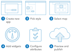
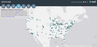
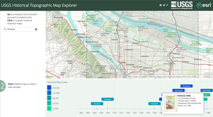
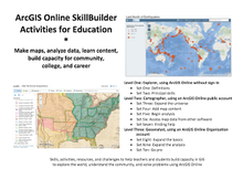
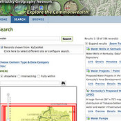
Setting up a ConnectEd Organizational account for your school is free and relatively simple. You will need at least one person to take the responsibility of being the organization administrator. Get started by going to ConnectEd. Scroll down the page to the instructions for setting up a free account. ArcGIS Online Story Map ArcGIS Online Story Maps enable you to add images and video to your map. Click this link to see an example of a Kentucky based Story Map. To learn more about making Story Maps go to Story Maps Tutorial. ArcGIS Web Apps You can use an ArcGIS Online app or create your own app to present your map. For example, if you have two layers you want people to compare, use the ArcGIS Online swipe app. Click this link to see a map on floods in the United States: US Flooding If you can't find an app that meets your needs, you could build your own. Go to Web App Builder to get started. GeoMentors Several GIS professionals have volunteered to be GeoMentors for educators and students. You may be able to find one near your school who would be willing to help your students with technical GIS questions. To find one, click on the link to the US K12 GIS map and click on tab 4 to see the GeoMentor Map. Detailed information for each GeoMentor is provide by clicking on the map dots. GeoMentor Map United States Geological Survey - Historic Maps The United States Geological Survey has mapped the United States for over 100 years. The topographic maps can be accessed by going to the link below. You can select the maps you want from any time period available for your hometown. The maps can be added to your ArcGIS map as a layer. It's a great way to show change using maps. Link to: USGS Historic Maps ArcGIS Online SkillBuilder Whether you are an ArcGIS Online beginner or experienced, you should download the SkillBuilder. The SkillBuilder presents three levels of ArcGIS Online skills with instruction on how to master each each level. Just go to ArcGIS SkillBuilder to download a copy and get started. Additional Sources for Map Layers The KyGeoNet is the Geospatial Data Clearinghouse for the Commonwealth of Kentucky. A variety of datasets can be located and downloaded, static map products can be viewed, and many web mapping applications and services are easily accessible. Use the powerful search capabilities of the KyGeoPortal to find downloadable data, explore Kentucky using the web maps found on the KyGovMaps page or connect directly to our Web Mapping Services using ArcGIS for Desktop. |

